


Offline Maps & AI Trip Planner
4.68.00 Reviews
App Specs
- Version
- 1.0.3
- Updated On
- License
- Free
- Downloads
- 100,000+
- Developer
- Aykonu
- Categories
- Maps & Navigation
- Platform
- Android
Screenshots
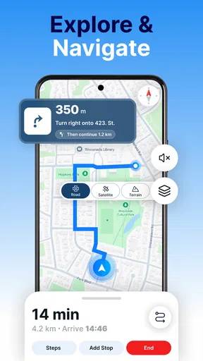
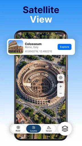
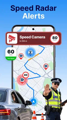
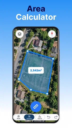

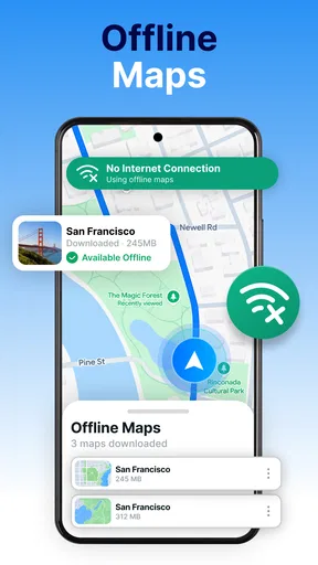
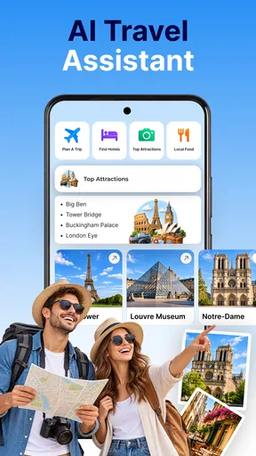
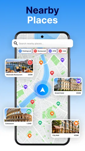
 Analysis by AppCompare
Offline Maps & AI Trip Planner is the kind of navigation app I would consider when I expect a weak signal, want to prepare a journey before leaving, or need more than a simple turn-by-turn route. It brings offline map downloads, AI-assisted trip planning, place discovery, and car tracking into one Maps & Navigation app from Aykonu. I found the idea practical, especially for travel days when relying on a constant connection feels risky.
My overall impression is positive, but I would not treat it as a universal replacement for every established navigation service. Its strongest appeal is the combination of preparation and flexibility: you can think through a trip before setting off rather than searching for every stop while moving. At the same time, the experience depends on how comfortably you can read, tap, and manage map information on your own device. That matters for people with different visual, motor, hearing, or cognitive needs, so I looked at the app not only as a route tool but also as something used in real, sometimes stressful situations.
How the map experience feels before and during a trip
I find the map experience most useful when I treat it as two stages: prepare calmly before leaving, then consult the saved area with as few changes as possible on the road. That distinction helps me decide what to download and which details to settle ahead of time, rather than relying on hurried map adjustments mid-trip. From there, it’s worth looking at how that preparation shapes a realistic day out.
Readability and navigation at a glance
The most useful starting point is the offline approach. I like downloading map material before a journey because it changes the task from “hope the connection works” to “prepare the area I actually need.” That is particularly valuable on rural roads, during international travel, or in places where mobile service changes from one stretch to the next. It also gives me a calmer planning process: I can review the route, identify likely stops, and avoid making the first important decisions after I have already started driving.
There is a practical trade-off here. Offline maps are only helpful if the relevant area has been prepared in advance and if I remember to check that the download covers the whole journey. A route that crosses several towns or regions requires more careful planning than a short trip inside one familiar area. I would therefore use the app the evening before travel, not minutes before departure. That small habit is one of the best ways to avoid turning an offline feature into a false sense of security.
For readability, I find map apps easiest when I can reduce the amount of information I need to process at once. I would plan the broad journey first, then inspect individual places, rather than constantly zooming and panning while trying to make a decision. Users with low vision may prefer a larger device, stronger system text settings, or a tablet during preparation, while someone with ordinary vision may still struggle with dense map labels in bright sunlight. The app can be useful in those contexts, but the physical screen and operating-system settings remain just as important as the app itself.
The AI trip-planning angle is more interesting than a basic map search because it suggests a conversational way to shape a day. Instead of treating every destination as a separate lookup, I can think in terms of an outing with multiple stops. A useful workflow would be to decide the main purpose of the journey first, then ask the planner to help organize places around it, and only afterward review the proposed sequence manually. I would not blindly follow an AI-generated plan: opening hours, road conditions, personal energy, and accessibility at individual venues still need human judgment.
Worth Reading Before You Choose

Baby Panda World Brings Quick Play to Modern Phones, but Its Game Library Feels Busy

ESPN’s Live Game View Makes Following Close Games Easier

QuizzLand Review: A Good Fit for Short Trivia Breaks, Not Every Player

Basketball Stars: Multiplayer Is Fast, but Can It Recover When Matches Go Wrong?

WEBTOON Turns Phone Updates Into a Better Reading Routine

Link to Windows Runs on Shared Habits, Not Social Feeds
This is where the app can help people who find conventional map interfaces mentally tiring. A clear planning request may be easier than building a multi-stop route by repeatedly searching, saving, and rearranging locations. However, AI suggestions can also create ambiguity. If a recommendation is vague, too ambitious, or based on assumptions about walking distance and available time, the user must be comfortable checking and correcting it. The feature is best viewed as a planning assistant, not as an authority.
Motor and sensory considerations
Navigation places unusual demands on fine motor control. A person may need to zoom, select a place, adjust a route, or start tracking a car while standing outdoors or sitting in a moving vehicle. I would always complete those tasks before driving. Even for users without a motor impairment, small map controls and repeated pinching can become frustrating when the phone is mounted at an awkward angle or when attention is divided.
For someone with tremors, limited reach, or reduced dexterity, the most comfortable approach is likely to prepare the journey while stationary and keep changes to a minimum once moving. The app’s value is higher when it reduces interaction during the trip. Saving the intended area offline and organizing key destinations ahead of time can turn a complicated sequence of taps into a quick glance and a simple confirmation. That is a meaningful design advantage in practice, even though it does not remove the need to interact with the phone during setup.
People with hearing loss may appreciate a navigation routine that does not depend on noticing spoken instructions, but I would not assume that every important alert is available in a visual form without checking the current device behavior. A user who cannot rely on audio should test the app on a short, familiar route and confirm that the information they need is visible at the right moment. Conversely, someone with low vision may depend more heavily on speech output or screen-reader behavior, and should test how place details and map controls are exposed before committing to an unfamiliar trip.
Screen readers can be excellent for lists, names, and written controls, but map canvases are often more complicated than ordinary text screens. I would approach this app with that distinction in mind. Searching for a destination or reviewing a place list may be more manageable than interpreting a crowded visual map. If a user needs highly dependable spoken guidance or specialized pedestrian support, a navigation product known for that specific workflow may be a better primary choice, with this app used for advance planning or offline reference.
Color perception is another everyday issue. Routes, roads, traffic information, and selected places can be difficult to distinguish when the visual hierarchy relies heavily on color. I would not plan a demanding journey based on color alone. Reading names, checking the route context, and confirming the destination are safer habits. Users who are sensitive to glare or visual clutter may find preparation easier indoors, where the screen can be enlarged and viewed without the pressure of an active journey.
Situational access in ordinary travel
The clearest everyday scenario for me is a weekend drive to a place where coverage is uncertain. The night before, I would download the area, use the planner to sketch a route with a main destination and a few possible stops, then inspect the result rather than accepting it automatically. In the morning, I could start with a prepared map instead of searching from scratch. If plans change, the offline material still gives me a useful geographic reference, while the connected features can help when service is available.
Car tracking adds another practical use case. In a large parking area, unfamiliar neighborhood, or busy event location, remembering where the vehicle is can be more useful than another list of restaurants. I would activate that kind of feature before walking away and treat it as a convenience rather than a substitute for noting a recognizable landmark. People with memory difficulties may benefit from reducing the number of details they must retain, but they should still make sure the saved vehicle position is understandable when they return.
The app also suits travelers who prefer to decide gradually. I might begin with a broad destination, identify places that fit the day, and then refine the route after seeing how much travel is realistic. That is different from the usual search-first habit, where every stop is chosen independently. The AI planner may reduce that fragmented feeling, especially for someone who finds trip organization overwhelming. The trade-off is that a flexible plan can become too full, so I would deliberately leave spare time rather than filling every part of the itinerary.
For families, the planning stage can be useful because one person can prepare the route while another checks whether the stops fit the group’s needs. For older travelers, the offline option may reduce anxiety about losing service, but I would keep the interface as simple as possible and avoid making last-minute changes on a small screen. For people traveling alone, car tracking and preselected places can provide a clearer routine, although I would still keep a backup plan for battery loss or an unexpected road closure.
The app’s Everyone age rating makes it broadly approachable from a content perspective. That does not mean every travel situation will be equally comfortable for every person. A child, someone with cognitive fatigue, or a user unfamiliar with maps may need another person to help prepare the first trip. In my view, inclusive use here depends less on age and more on whether the planning process is broken into manageable steps.
Where the experience still has barriers
The first barrier is preparation. Offline navigation is not magic: it rewards users who remember to download the correct area and verify that the planned journey fits inside it. Someone with limited data, limited storage, or difficulty managing downloads may find the feature harder to use than its simple description suggests. I would make the download part of a repeatable checklist and avoid assuming that a single saved area covers every detour.
The second barrier is trust. AI can make planning feel easier, but it can also encourage users to accept a polished-looking itinerary without checking the details. I would review every suggested stop for distance, timing, and personal suitability. This is especially important for wheelchair users, people who tire easily, families with young children, and anyone who needs step-free or low-stress access. A place appearing on a map does not automatically tell me whether reaching it is practical.
Another limitation is the difference between planning and live navigation. The app’s combination of offline maps and trip organization is compelling, but users who need highly specialized guidance for walking, cycling, public transport, or accessibility-focused routing may prefer an alternative built primarily around that mode. A conventional navigation service with mature live traffic information may also be the better choice for daily commuting, where current road conditions matter more than itinerary design.
Cost deserves a quick look as well. The app is free to download and use as a starting point, while optional in-app purchases range from a few dollars to just under thirty dollars per item. I would check which functions are included before planning an important trip around them. The free entry point makes experimentation easy, but anyone trying to keep travel tools entirely cost-free should understand that some extras may require payment.
Its current version is 1.0.3, and the app has passed ten thousand installs. I read that as a young, still-growing product rather than a tool with the long-established familiarity of the biggest navigation platforms. The average score is a perfect five from eighty-eight ratings, alongside three written reviews, which is encouraging but also a relatively small feedback base. I would test it locally before relying on it for a complicated journey, particularly if accessibility needs make failure costly.
Device compatibility is reasonably broad because it supports Android 7.0 and later. That helps people using older phones, although an older handset may still have a smaller or dimmer display, less storage, or slower performance than a newer model. Those hardware differences can affect map readability and interaction comfort. I would consider the phone itself part of the accessibility setup rather than judging the app in isolation.
An inclusive verdict for different travelers
I recommend Offline Maps & AI Trip Planner to people who enjoy preparing journeys, want an offline safety net, and like the idea of turning several destination searches into one organized plan. Its best qualities appear when I use it before leaving: download the region, shape a sensible itinerary, check the suggested places, and save the information I am likely to need. That workflow can reduce stress for travelers who dislike improvising with a weak connection.
I am more cautious about recommending it as the only navigation tool for users who require specialized accessibility guidance, highly dependable live updates, or a fully tested screen-reader experience. In those cases, I would compare it with a service designed specifically for the travel mode or assistive workflow involved. This app can still be valuable alongside that service, particularly for offline preparation and keeping a car location available.
My practical advice is to begin with a familiar local trip. Test map downloads, place search, the AI planning process, and car tracking while stationary. Adjust the phone’s text size, contrast, speech, and touch settings before trying an unfamiliar route. Then judge whether the information is easy to find without rushing. The most inclusive way to use this app is to make it reduce decisions during travel, not create new ones.
For a free Maps & Navigation app from Aykonu, it offers a thoughtful mix of preparation tools and everyday convenience. I would not promise that it fits every ability or every journey, but I do think it has a clear place for travelers who want offline confidence and a more natural way to assemble a day out. If that describes you, Offline Maps & AI Trip Planner is worth testing on a low-risk route before making it part of your regular travel routine.
Pros
- Maps remain available when traveling without mobile data.
- AI suggestions help organize routes and daily activities quickly.
- Useful place categories make nearby attractions easy to discover.
- Trip plans can be adjusted as travel preferences change.
- Can reduce roaming costs during international trips.
Cons
- Offline map downloads can require considerable storage space.
- AI recommendations may include outdated or inaccurate information.
- Some advanced planning tools may require an internet connection.
- Battery usage can increase when GPS navigation runs continuously.
- Coverage and place details may vary by country or region.
FAQs for Offline Maps & AI Trip Planner
What is Offline Maps & AI Trip Planner, and what can it do?
Offline Maps & AI Trip Planner combines downloadable maps with an AI-powered travel planning tool. You can use it to search for destinations, organize places of interest, build day-by-day itineraries, and navigate when mobile data is unavailable. It is especially useful for road trips, international travel, hiking areas, or locations where cellular coverage is unreliable.
Can I use the maps without an internet connection?
Yes, the app is designed to support offline navigation after you download the required map areas in advance. Before traveling, connect to Wi-Fi and save the regions, cities, or routes you expect to visit. Offline availability may depend on the selected area and feature, since some live information, online searches, traffic updates, and cloud-based AI functions may still require an internet connection.
How does the AI trip planner create itineraries?
The AI trip planner generally builds suggestions from information such as your destination, travel dates, interests, available time, transportation preferences, and desired pace. It can recommend attractions and arrange them into a practical schedule. However, its suggestions should be treated as a starting point rather than a guaranteed plan, because opening hours, weather, local events, travel times, and personal preferences can change.
Does Offline Maps & AI Trip Planner provide turn-by-turn navigation and live traffic?
The app can help with route planning and navigation, including guidance based on downloaded map data where supported. Turn-by-turn instructions may work offline, but live traffic, road closures, public transportation changes, business availability, and other real-time information usually require an active internet connection. Always review the route before departure and follow local road signs while driving.
Is Offline Maps & AI Trip Planner free to download, and are there in-app purchases?
The application may be free to install while offering optional premium features, subscriptions, or purchases for expanded map coverage, advanced AI planning, extra navigation tools, or an ad-free experience. Pricing and available features can vary between Android and iOS and may change over time. Check the app store listing and subscription terms carefully before confirming any payment.


